
- Borrowing from central bank ‘suicidal’ for economy: Dr. Fahmida |
- Fuel Queues Ease As Supply Rises, Demand Falls |
- PM says govt working to reopen closed factories |
- 7-year Sukuk worth Tk 5,900cr planned for rural bridge project |
- Unplanned bundhs worsen flooding, crop losses in Sunamganj haors |
Unusual April Rains Raise Flood Fears in Haor Regions
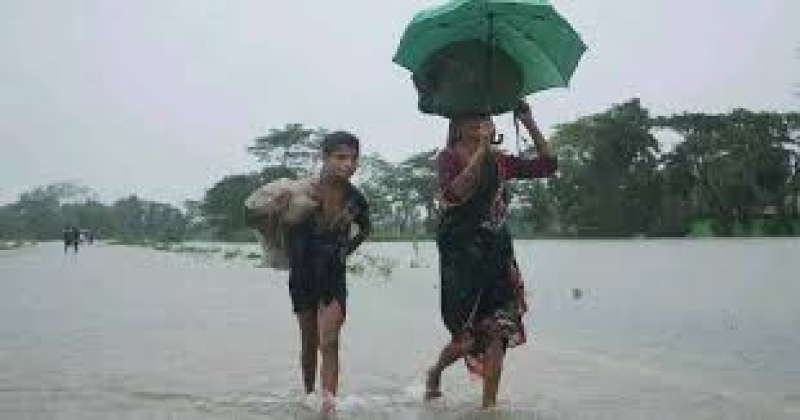
Photo collected
Bangladesh has just gone through an unusually wet April, with rainfall about 75 percent higher than normal, and the impact is already being felt across low-lying haor areas in the northeast where rivers are swelling and flood risks are rising.
Weather experts say the pattern this year has been far from typical. Instead of short, scattered spells of rain lasting a few days, the country saw prolonged rainfall stretching over more than a week at a time. This shift has disrupted the usual seasonal rhythm and put pressure on river systems much earlier than expected.
Meteorologists link the heavy rain to a series of active western depressions—weather systems that form far away over the Mediterranean region and travel eastward. These systems usually weaken before reaching Bangladesh, but this year several of them remained strong and arrived almost back-to-back. The effect was a sustained period of rainfall rather than isolated showers.
The situation was further shaped by an extended dry spell earlier in the year. After minimal rainfall through much of winter, the atmosphere built up conditions that intensified these incoming systems. In contrast, April last year was dominated by a long heatwave, highlighting how sharply weather patterns can shift from one year to the next.
Rain is not letting up just yet. Forecasts indicate that showers and thunderstorms will continue across much of the country over the next several days, particularly in divisions like Mymensingh, Dhaka, Barishal, Chattogram and Sylhet. Some areas, in the northeast and southeast, may withness heavy to very heavy rainfall accompanied by gusty winds. Temperatures are expected to remain steady for now, before rising slightly later in the week as rainfall gradually eases.
While the rain has brought some relief from heat, it is creating growing concern in haor regions, where even a small rise in water levels can quickly lead to flooding. In Sunamganj, Netrakona and Habiganj, water at several monitoring points has already crossed pre-monsoon danger levels.
Rivers such as the Naljur, Bhugai-Kangsa, Someshwari, Magra and Sutang are under close watch. Some rivers have held steadyus 24 hours in the previwhile others have shown a gradual rise, especially in areas receiving heavy upstream rainfall. The haor basins themselves have seen intense downpours, adding to the pressure.
Flood forecasters warn that the Surma and Kushiyara river system may rise further in the coming days, with certain points likely to cross danger levels soon. If that happens, nearby low-lying villages and croplands could be inundated.
Water levels in Netrakona rivers like Bhugai-Kangsa and Someshwari are likely to remain steady but high that may prolong thexisting waterlogging. Meanwhile, the Dhanu-Baulai river system is rising and could cross danger levels in places such as Khaliajhuri within the next couple of days.
Conditions in Habiganj and Moulvibazar are also becoming more fragile. Rivers including the Khoai, Sutang, Manu and Juri are on an upward trend, with some expected to cross danger thresholds soon. This raises the risk of fresh flooding in already vulnerable haor communities.
For farmers in these haor regions, the timing is deeply worrying. It is the final stretch of the boro harvest, when fields are heavy with nearly ready crops. A sudden rise in water now could undo months of effort within hours, leaving many with little to salvage.
Authorities say they are closely monitoring the situation and have asked local administrations and residents to remain alert. With more rain expected and rivers already under pressure, the next few days may prove crucial for communities across the flood-prone northeast.