- Let's build a society of love, tolerance, peace and harmony: Tarique Rahman |
- Bangladesh at a Crossroads as 2025 Reshapes the Nation |
- Khaleda Gets Eternal Farewell from Over a Million of Hearts |
- Sea of Mourners Gathers to Pay Tribute to Khaleda Zia |
Cyclone ‘Dana’ to Hit Oct 24, 7-Foot Surge Expected

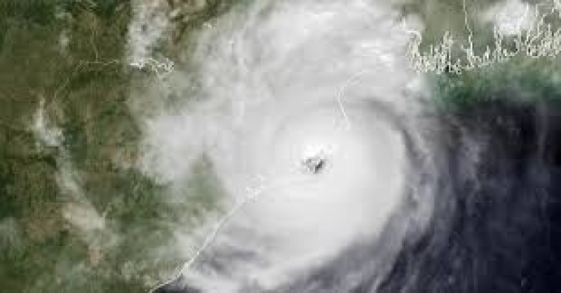
Cyclone ‘Dana,’ a formidable storm brewing in the Bay of Bengal, is projected to strike the coasts of Bangladesh and India on October 24, posing a significant danger to coastal communities.
According to the India Meteorological Department (IMD), the cyclone originated from a low-pressure system over the Andaman Sea, intensifying rapidly. As of Monday, meteorologists reported that this system has escalated to a well-marked low-pressure area, with wind speeds reaching approximately 50 km/h.
The storm is expected to make landfall between midnight on October 23 and 6:00 PM on October 24, primarily affecting the coastal regions of Odisha and West Bengal in India, and the districts of Satkhira and Khulna in Bangladesh. Areas such as Midnapore and South 24 Parganas are also likely to face severe impacts.
Potential Impact on Bangladesh
With satellite data indicating a surge in the storm's intensity over the past 24 hours, wind speeds may escalate to between 110 and 120 kilometers per hour, raising concerns over potential devastation to infrastructure and agriculture.
Storm Surge Warnings
The most alarming threat from Cyclone Dana is the anticipated storm surge, particularly if it coincides with high tide. Coastal districts, including Satkhira, Khulna, and Bagerhat, could see surges of 7 to 8 feet above normal tidal levels. During low tide, surges may still reach between 3 and 5 feet.
Further south, districts such as Barguna, Patuakhali, and Bhola may experience surges of 5 to 6 feet at high tide and 1 to 3 feet during low tide. Other areas, including Noakhali and Chattogram, are likely to encounter surges of 3 to 5 feet, while Cox’s Bazar may see lower surges of 2 to 4 feet.
Authorities Urge Vigilance
Officials are urging residents in vulnerable coastal areas to remain alert and prepare for potential evacuations. Local authorities are implementing preemptive measures to alleviate the impacts of flooding and high winds, with shelters being prepared for evacuees.
As Cyclone Dana approaches, residents are advised to stay informed and heed local warnings. Authorities continue to monitor the evolving situation, promising timely updates as more information becomes available.

