
- JS passes Tk 9.38 lakh crore budget for FY27 |
- Court ruling blocks Aslam Chowdhury’s MP oath |
- Prioritise natural resources regeneration in budget to make dev holistic |
- Finance Bill passed, tax-free threshold set at Tk 4 lakh |
- PM calls FY27 budget 'life-friendly', promises relief |
India transmits flood flow data on common rivers to BD
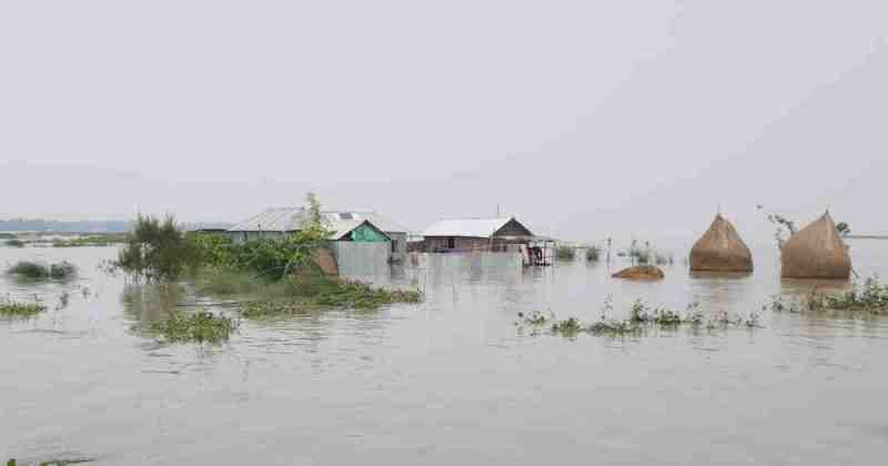
Flood in northern Bangladesh. Representational image.
Dhaka, May 2 - With the start of the flash flood season, India has started transmitting flood related data of identified stations on trans-boundary rivers flowing to Bangladesh, through the Joint Rivers Commission.
Under the aegis of Bangladesh-India Joint Rivers Commission framework, India has been sharing flood related data such as Water Level, Forecast Level, Discharge and Rainfall of identified Indian stations on common rivers such as, Brahmaputra, Barak, Manu, Gumti, Teesta, Jaldhaka, Torsa, Mahananda and Ganga for the purpose of flood forecasting and warning in Bangladesh.
The arrangement of flood data transmission has been periodically reviewed and revised in the past as per the request of Bangladesh and presently, the data of the identified Indian stations is being transmitted to Bangladesh on a continuous basis during the designated flood period.
Earlier, the designated period of flood data transmission was from 1st May to 15th October, which was extended to 31st October in the year 2022 to accommodate the flood situations arising out of delayed retreating monsoon.
Last year, a WhatsApp group of concerned officers of Bangladesh and India, engaged in the flood forecasting and warning activities, was also set up for seamless and timely data transmission, and this messaging group has also been re-activated on May 1, 2024. - UNB